We developed a method for measuring vehicle occupancy levels along a corridor.
A key issue is how to define a corridor. In central Los Angeles, for example, dozens of
arterials are used as east-west corridors. In other cities, a corridor may be
defined only by a single central road, such as a freeway.
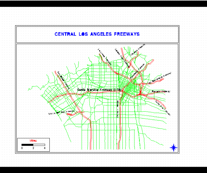
This map shows the major arterials which are parallel to the Santa Monica
Freeway. In developing a sampling frame for the
measurements, the analyst needs to determine how far from the central freeway, the
corridor needs to run. In this case, we decided on a two-mile band around the
Santa Monica Freeway. The procedure then eliminates all arterials outside of
this band as well as arterials which do not traverse the distance over which the
measurements will be taken (in this case, from the San Diego Freeway on the west to
the Harbor Freeway near Downtown Los Angeles).
After the eligible streets are selected, a universe of traffic volumes along the
eligible freeways and arterials is developed, usually from Department of
Transportation traffic volume tables, and a random sample of segments is taken.
Each segment defines a location, which is then measured during a single day in
the year during both a morning and an afternoon peak period. See the study article
for details.